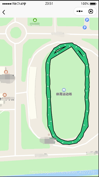
Demo
<template>
<view class="img_box">
<map :latitude="latitude" :longitude="longitude" scale="18" :polyline="polyline"></map>
</view>
</template>
<script>
import {
stuExerciseRecordDetail
} from '@/api/sports.js'
export default {
data() {
return {
runid: -1,
latitude: 39.96491,
longitude: 116.31604,
polyline: [{
points: [],
color: "#31c27c",
width: 10,
arrowLine: true,
borderWidth: 2
}]
};
},
mounted() {
if (this.runid != -1) {
stuExerciseRecordDetail(this.runid).then((data) => {
this.latitude = data[0][1]
this.longitude = data[0][0]
let points = []
data.forEach(item => {
points.push({
latitude: item[1],
longitude: item[0]
})
})
this.polyline = [{
points: points,
color: "#31c27c",
width: 10,
arrowLine: true,
borderWidth: 2
}]
})
}
},
onLoad: function(option) {
this.runid = option.runid
}
}
</script>
<style lang="scss">
.img_box {
position: absolute;
top: 0;
bottom: 0;
left: 0;
right: 0;
map {
width: 100%;
height: 100%;
}
}
</style>
效果
cs